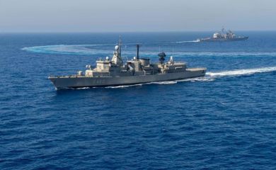
“Corinth among the world’s earthquake supersites: Earthquakes cannot be predicted..
 ΧΡΟΝΟΣ ΑΝΑΓΝΩΣΗΣ 9 '


Remote Sensing provides valuable data to track tectonic activity, study seismic zones, and evaluate potential earthquake impacts. By using satellite imagery and geospatial technology, remote sensing aids in mapping surface deformations pre- and post-earthquake, aiding in risk assessment and management. The consequences of earthquake occurrences are widely known on the impact the have on the society, economic, civil protection and science. Can satellite sensing assist in the prevention process? Can earthquakes be predicted? Doctor Stefano Salvi has the answers.
Dr. Salvi participated the 44th annual “International Geoscience and Remote Sensing Symposium – IGARSS 2024” of the IEEE Geoscience and Remote Sensing Society, in Athens from 7-12 July 2024.
Dr. Stefano Salvi is technological director at the National Institute of Geophysics and Volcanology (Istituto Nazionale di Geofisica e Vulcanologia: INGV), Osservatorio Nazionale Terremoti (ONT), Rome, Italy. In 1999 he founded the ING Remote Sensing Laboratory, and in 2001 the INGV Geodesy and Remote Sensing Laboratory. He works in a research group including engineers, geophysicists and geologists experienced in the use of space geodetic data for the study of ground deformation due to various phenomena, earthquakes, volcanoes, tectonics, gravitational mass movements, sinkholes, anthropogenic subsidence. He has authored over 80 papers on peer-reviewed journals on these subjects. He has been PI or co-PI for several research projects funded by EC, ESA, ASI, NASA, Italian Antarctic program, national and bilateral research programs, on the use of remote sensing data and techniques for geophysical applications and geohazard assessment. He coordinates the Italian Joint Research Unit supporting the European Plate Observing System (EPOS). He is a member of the CEOS Working Group on Disasters and co-lead of the CEOS Seismic Risk Initiative. Since 2014 he is Chair of the Scientific Advisory Committee of the GEO-Geohazard Supersites and Natural Laboratories global initiative.
Dr. Salvi, could you please tell us about your research interests and impact?
I work at the Italian National Institute of Geophysics and Volcanology in Rome. In my research group we mainly carry out research based on remote sensing data on earthquake and volcanic hazards and provide support for monitoring earthquakes and volcanoes for the Italian Civil Protection. I am also advocating for Open Science, and manage an open-data global initiative called the Geohazard Supersites and Natural Laboratories, established in 2007 in the framework of the Group on Earth Observations (GEO). The initiative has created a network of 14 Geohazard Supersites, which are special seismic and volcanic areas where scientists freely exchange ground and satellite data and collaborate using an Open Science approach.
In Greece we have the Enceladus Hellenic Supersite, which covers the Corinth Gulf from the Ionian islands to Athens and is a seismic supersite, coordinated by the Greek Civil Protection. We help the scientists which are part of the supersite community to obtain satellite data from global space agencies and they use these data to explore and monitor the earthquake hazard before and after the earthquakes and to assess their consequences.
How does this supersite programme work?
In essence the supersite programme connects local and international scientists and scientific institutes with global space agencies and with the local civil protection agencies. These are the three main stakeholders. The scientists receive useful satellite data from the space agencies and provide access to in-situ data acquired by their own network; they generate scientific results or services to monitor the occurrence of volcanic and seismic activity and provide them to the local civil protection agencies.
Among the supersites we have the San Andreas fault in California, the Hawaiian volcanoes, the Iceland volcanoes, the Marmara fault near Istanbul, and several other seismic and volcanic areas in New Zealand, Italy, China, Ecuador, Nicaragua, Chile, Russia. For example, the two Italian volcano Supersites are coordinated by INGV, which is the main reference institute for monitoring volcanic and seismic activity in Italy. All the research results we generate using satellite data and ground data are then delivered to the Italian civil protection and to other government agencies, to be used for decision-making in hazard assessment, risk prevention and of course for response to a damaging earthquake.
Why is Corinth important supersite in relation to the other thirteen?
The Corinth Gulf is an area where active seismic faults have been mapped on both sides of the sea channel, and are generally oriented East-West. Such faults can generate large earthquakes, and the area is constantly monitored by ground instruments. Using satellite data and especially radar data, it is possible to accurately measure the deformation of the ground through time, with a spatial resolution of a few meters. These data can provide images of how the ground is moving through time -e.g. 10-20 years-time- with a precision of few millimeters per year.
Earthquakes are generated when the long-term stress accumulated by the tectonic plates motion overcomes the resistance level of the faults, thus by studying the plate motions and deformations at the surface the scientists investigate the earthquake generation process.
So, can there be a prediction model for earthquakes?
The time occurrence of earthquakes cannot be accurately predicted, but for a given area or fault you can calculate the probability of occurrence of any ground shaking level, within a given time interval. So scientists can give structural engineers fundamental data to design seismically resistant buildings which can withstand the local maximum ground shaking level.
For instance, studies using also satellite data have calculated a very high probability of occurrence, between 40 and 70 %, of a large magnitude earthquake (larger than M 7) in Istanbul during the next 30 years. These kinds of studies are important to map the seismic hazard, which is then useful to civil protection agencies to put in place a number of different measures aiming at preventing or reducing the consequences of such events.
And now, with the satellite technology, how do you use the influx of data to have a better and more accurate picture?
For earthquake hazard investigations we use a technique called Synthetic Aperture Radar (SAR) interferometry to continuously monitor the ground deformation. This technique was developed starting 30 years ago, and today it is blooming due to the availability of a growing number of radar satellites, being deployed by national space agencies and commercial companies. However, not all these satellite data are openly accessible by scientists, and the Geohazard Supersite initiative aims at fulfilling this information gap.
How does the use of AI impact your field of research?
There is a lot of work going on in this field and AI is being used especially for data modelling. Presently the majority of the models that we use are based on a deterministic assessment. AI uses statistical techniques based on large information databases and it is likely that its use will gain weight in the next 10 years.
Do you think we will be able to have a prediction model in the future having all this Technology ?
Earthquakes cannot be predicted, due to a large variety of still poorly known conditions that drive their triggering, and the difficulty of acquiring information from the considerable crustal depths at which they nucleate.
Predicting earthquakes is like predicting when you will catch a cold. The event is subject to several different conditions and variables which make a precise prediction (minutes, hours or days) impossible. Of course in the future we will have the computer capacities and AI techniques which might allow to refine these times, but it will likely take many more years anyway
Διαβάστε όλες τις τελευταίες Ειδήσεις από την Ελλάδα και τον Κόσμο


Το σχόλιο σας