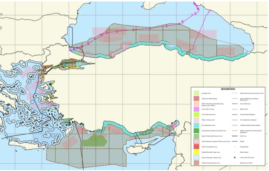
Ankara is attempting to counter Greece’s Maritime Spatial Plan (MSP) by submitting its own map to UNESCO, directly challenging Greek maritime zones.
The map, prepared by Ankara University, reflects several of Turkey’s long-standing positions.
It effectively splits the Aegean Sea in half, incorporating the maritime zones of numerous Greek islands into Turkey’s proposed maritime jurisdiction.
Turkey asserts that islands are not entitled to full maritime zones beyond a 6-nautical-mile territorial sea – an interpretation that diverges from the prevailing view in international maritime law, as upheld by Greece and the majority of other nations.
In the Eastern Mediterranean, Turkey’s map extends to the boundaries outlined in the Turkish-Libyan maritime memorandum, an agreement that Athens firmly rejects as illegal and invalid. It also highlights areas licensed to the Turkish Petroleum Corporation (TPAO) for exploration activities.
In April, Greece completed its national Maritime Spatial Plan and published the corresponding official map, outlining its maritime zones in the Aegean and the Eastern Mediterranean.
Ankara rejected the Greek plan, arguing that it infringes on Turkey’s claimed maritime jurisdiction in both regions.
Source: pagenews.gr